
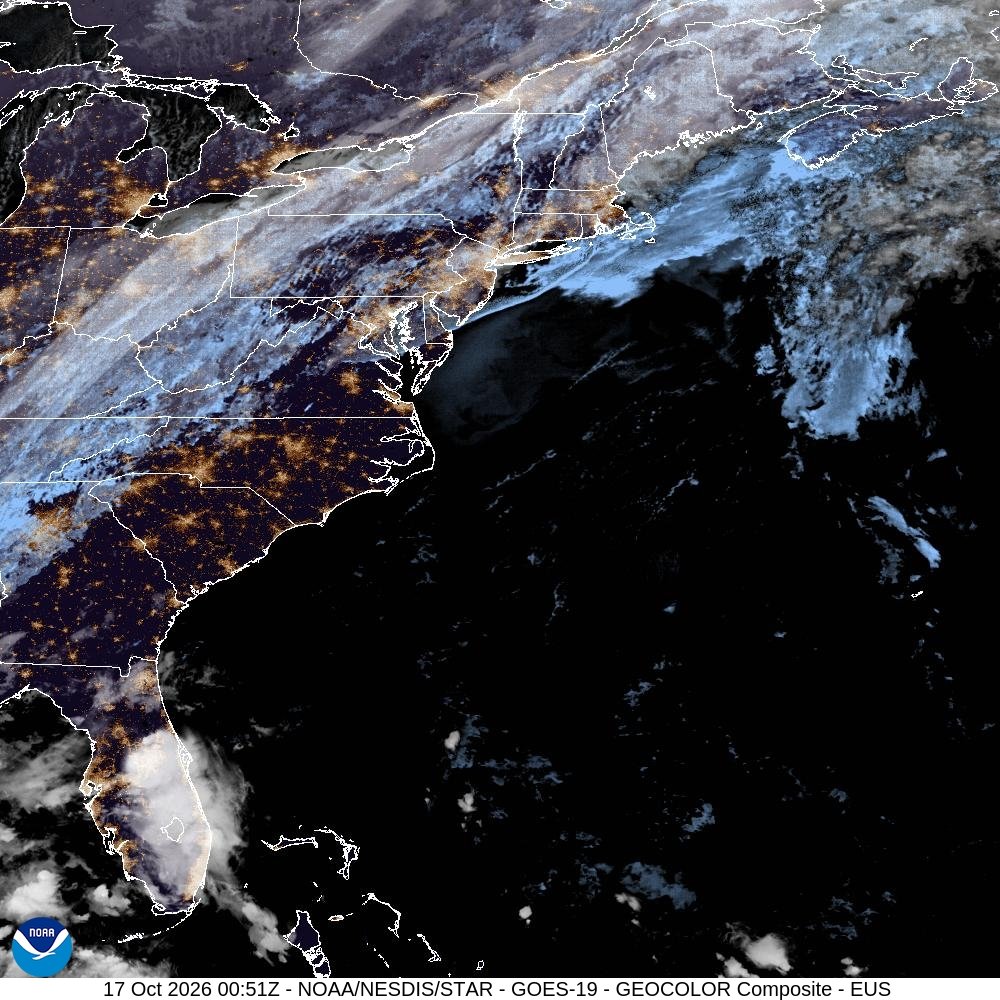
How is AI used in weather forecasting and storm tracking? If your weather app seems dramatically better than it was five years ago — more accurate 7-day forecasts, eerily precise rain timing, hurricane tracks that nail landfall days in advance — you’re not imagining it. AI has quietly revolutionized meteorology — one more domain where AI works invisibly in everyday life — and 2024-2026 saw the breakthrough moment: AI models officially outperforming the traditional physics-based systems that ruled forecasting for decades. Here’s how the sky got predictable.
How Is AI Used in Weather Forecasting and Storm Tracking?
Traditional forecasting uses numerical weather prediction (NWP): massive supercomputers solving physics equations for the atmosphere, divided into 3D grid boxes. It’s scientifically beautiful and computationally brutal — a single global forecast can take hours on a supercomputer. And it has inherent limits: the equations are approximations, the grid can’t capture small-scale phenomena, and tiny input errors compound over time (the famous butterfly effect).
AI models take a radically different approach: instead of solving physics equations, they learn patterns from decades of historical weather data. Google’s GraphCast, Huawei’s Pangu-Weather, and ECMWF’s AI models train on 40+ years of atmospheric observations, learning how weather systems evolve. The result: forecasts that match or beat traditional models, generated in minutes on a single GPU instead of hours on a supercomputer. When GraphCast’s results were published, showing it outperformed the world’s leading traditional system on most metrics, it was meteorology’s “AlphaGo moment.”
How Is AI Used in Weather Forecasting Day to Day?
- Your app’s forecast: That 10-day outlook and hourly rain probability increasingly come from AI models or AI-enhanced traditional models. The “rain starting in 20 minutes” precision is AI pattern-matching on radar data.
- Hurricane tracking: AI models now produce track forecasts rivaling the best traditional guidance, with faster updates as storms evolve. Intensity prediction — historically the hardest problem — is improving as AI learns subtle pre-intensification patterns humans miss.
- Severe weather warnings: AI analyzes radar, satellite, and sensor data to detect tornado signatures, flash flood conditions, and hail threats faster than human forecasters scanning the same data — buying precious extra minutes of warning.
- Long-range outlooks: Seasonal predictions (will this winter be harsh? is drought coming?) benefit from AI finding teleconnections — like El Niño’s ripple effects — in historical data. Travelers are increasingly using these outlooks too, as AI reshapes travel planning around weather windows.
- Hyperlocal nowcasting: AI excels at 0-6 hour predictions for specific locations, blending radar, satellite, and ground sensors into street-level forecasts.
The NOAA’s AI initiatives page documents how deeply these tools have integrated into operational forecasting.
Storm Tracking: Where AI Saves Lives
The life-saving application is severe weather. AI systems now monitor satellite and radar feeds continuously, flagging developing threats for human forecasters: rotating thunderstorms that might spawn tornadoes, rapid hurricane intensification, flash-flood rainfall rates. The AI doesn’t replace the forecaster’s warning decision — it ensures no threat goes unnoticed in the data deluge, and it buys time. In tornado scenarios, even 5-10 extra minutes of warning measurably reduces casualties. That’s the real stakes of better forecasting.
The Limits (Because Physics Still Matters)
AI forecasting has genuine limitations. Extreme unprecedented events are the big one: AI learns from history, so events outside historical experience (record-shattering heat domes, unprecedented rainfall) are where AI can stumble most — precisely when accuracy matters most. Physical consistency is another: AI models can produce forecasts that violate physics in subtle ways, which is why the best operational systems blend AI with traditional physics-based models rather than replacing them.
And the butterfly effect hasn’t been repealed: beyond 10-14 days, the atmosphere is fundamentally chaotic, and no model — AI or otherwise — can beat that. Anyone selling you a precise 30-day forecast is selling horoscopes. AI extended the skillful forecast horizon by days, which is huge, but it didn’t eliminate uncertainty.
How to Read Forecasts Like a Meteorologist
Understanding what AI did and didn’t change makes you a smarter forecast consumer. Trust the 1-3 day forecast heavily — modern AI-enhanced models are remarkably accurate here, and hour-by-hour precipitation timing is genuinely reliable now. Use the 4-7 day forecast for planning with appropriate humility — the general pattern (warm/cold, wet/dry) is solid, but specific timing shifts. Treat 8-14 day outlooks as trends only — directionally useful, specifically unreliable.
Understand probability: “40% chance of rain” doesn’t mean it will rain 40% of the time — it means 40% of similar forecast situations produced measurable rain at your location. AI improved these probabilities’ calibration, but they’re still probabilities. Watch the cone, not the line, for hurricanes — the track line is the most likely path, but impacts extend far beyond it, and AI’s improved track accuracy doesn’t eliminate the cone’s uncertainty.
Use multiple sources for high-stakes decisions. Your app, the National Weather Service forecast discussion (which explains the reasoning — invaluable), and local TV meteorologists who understand your microclimate. AI made each source better; combining them makes you better informed than any single source.
Climate Change and the Forecasting Challenge
Here’s the sobering context: AI forecasting learns from history, but climate change is making history less predictive. Unprecedented extremes — the events where AI is weakest — are becoming more common. This creates a paradox: forecasting is better than ever for normal weather and potentially shakier for the abnormal weather that’s increasing. Meteorologists are actively working on hybrid approaches — AI pattern-matching constrained by physics, trained on climate-model projections of future conditions, not just past observations. The science is adapting as fast as the climate is changing, which is to say: urgently, and not quite fast enough.
The Practical Takeaway
AI is used in weather forecasting through deep learning models trained on decades of atmospheric data, now matching or beating traditional physics-based systems at a fraction of the computational cost — powering your app’s forecasts, hurricane tracking, severe weather warnings, and hyperlocal nowcasting. The result: more accurate forecasts, faster warnings, and lives saved. Just remember the limits: unprecedented extremes and beyond-two-week horizons remain humbling for every model. Check your forecast, respect the warnings, and appreciate the quiet AI revolution happening above your head.





One Comment