
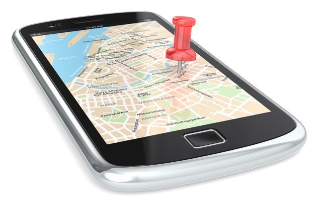
Landing in a foreign city used to mean unfolding a paper map on the sidewalk like a lost extra in a movie. Now your phone is a local guide, translator, and transit expert — if you have the right apps. But the app store is a minefield of 2-star navigation apps and data-hungry tourist traps. So what are the best apps for navigating a foreign city? The ones that work offline, respect your battery, and actually understand local transit. Here’s the essential kit.
I’ve navigated 30+ foreign cities with these apps. The difference between having them and not is the difference between confident exploring and anxious wandering. Download and set them up BEFORE you leave — airport Wi-Fi is not the time for app configuration.
The Core Navigation Stack
Google Maps (the default champion)
Still the best all-rounder: walking, driving, and — critically — public transit directions in most major cities worldwide, with real-time delays. The killer feature travelers underuse: offline maps. Before you leave Wi-Fi, download the entire city/region (search the city → tap the name → Download). Offline Google Maps handles navigation, search, and saved places without data. Also save your hotel and key spots with stars — your personal map layer.
Maps.me / Organic Maps (the offline specialists)
Built for offline-first use with excellent detail (hiking trails, footpaths Google misses). Download the country/region maps in advance. Invaluable in places with spotty coverage — rural areas, developing countries, subway systems. Organic Maps is the open-source, ad-free fork; either works.
Citymapper (the transit whisperer)
In the 100+ cities it covers (London, Paris, NYC, Tokyo, etc.), Citymapper beats Google for transit: real-time departures, step-by-step “get off in 3 stops” guidance, cost comparisons across options (transit vs. rideshare vs. bike), and disruption alerts. If your destination is covered, it’s the primary transit app. Check coverage before relying on it.
What Are the Best Apps for Navigating a Foreign City? Beyond Basic Maps
Local transit apps (often essential)
Many cities have official transit apps that outperform Google: Tokyo’s Japan Travel/Jorudan, London’s TfL Oyster/TfL Go, Paris’s RATP/IDF Mobilités. They handle mobile ticketing (buy passes in-app, skip ticket lines), service alerts, and local quirks. Research your destination’s official app — it’s usually the transit authority’s, and it’s usually excellent.
Rideshare and taxis
- Uber works in 70+ countries — check availability at your destination.
- Bolt dominates Eastern Europe, Africa, and parts of Latin America (often cheaper than Uber).
- Grab is essential in Southeast Asia (rides, food, everything).
- DiDi covers Latin America and parts of Asia.
- Download the local one before you need it at midnight outside the train station.
Translation + navigation combo
Google Translate with offline language packs downloaded: camera translation for signs and menus (point and read — genuinely magical), conversation mode for asking directions. Download your languages before departure. For food specifically, this pairs with finding authentic local food — translating menus opens up the non-tourist restaurants.
Finding your way socially
- WhatsApp: The global messaging default — your tour guide, Airbnb host, and new friends will all use it. Install before you go.
- Google Lens: Point at landmarks, plants, menus, signs — visual search that answers “what am I looking at?”
The Practical Setup (Do This Before Departure)
- Download offline maps for every city/region (Google Maps + Maps.me redundancy).
- Download offline translation packs for your languages.
- Install local transit and rideshare apps; create accounts and add payment methods on home Wi-Fi.
- Get connectivity sorted: eSIM (Airalo, Holafly — buy before departure, activate on landing) or confirm your carrier’s international plan. Navigation without data is possible (offline maps) but much better with it.
- Save key locations: Hotel, embassy, hospitals, your country’s consulate. Star them in Google Maps.
- Screenshot or save hotel address in the local language/script — show it to taxi drivers when pronunciation fails.
Battery and data discipline
Navigation is a battery hog. Carry a power bank (10,000mAh minimum — and check TSA rules for batteries), download rather than stream maps, and use battery-saver mode. A dead phone in an unfamiliar city at night is a safety issue, not just an inconvenience — see solo traveler safety for why this matters.
Essential App Download Checklist
Run through this 48 hours before departure — on home Wi-Fi, not airport Wi-Fi:
- ☐ Google Maps: Download offline maps for every city/region. Star your hotel, embassy, and key sights.
- ☐ Maps.me or Organic Maps: Download country maps as offline backup. (Yes, redundant — redundancy is the point.)
- ☐ Citymapper or local transit app: Check coverage for your destination; install the official transit authority app regardless.
- ☐ Local rideshare app: Uber/Bolt/Grab/DiDi per destination — account created, payment method added, tested.
- ☐ Google Translate: Offline language packs downloaded for all your languages. Test camera translation once.
- ☐ WhatsApp: Installed and verified — guides, hosts, and new friends all use it.
- ☐ eSIM app: Airalo/Holafly — plan purchased, QR code saved, installation instructions read.
- ☐ Airline + hotel apps: Boarding passes offline, booking confirmations screenshotted.
- ☐ Currency converter: XE with offline rates, or just use Google — know the rough rate by heart anyway.
- ☐ Emergency info: Embassy address screenshotted, local emergency number saved in contacts, travel insurance details offline.
Then: phone fully charged, power bank fully charged, and a paper backup of the hotel address in the local language. Digital preparation is wonderful until the battery dies — the paper backup is the belt to your suspenders.
When Your Phone Dies: The Paper Backup
All the apps in the world don’t help with a dead battery. The 5-minute paper backup, made at the hotel before heading out: hotel name and address written in the local language/script (show it to any taxi driver), the nearest metro station to your hotel, your country’s embassy address and phone number, and the local emergency number. One index card in your pocket. It weighs nothing, needs no charge, and has saved more travelers than any app. Pair it with the power bank discipline (charged nightly, carried daily) and you’re covered in both worlds — digital convenience with analog insurance. The best-prepared travelers aren’t the ones with the most apps; they’re the ones with a backup for the apps.
The Takeaway
The best apps for navigating a foreign city form a stack: Google Maps (with offline downloads) for general navigation, Maps.me/Organic Maps as offline backup, Citymapper or the local transit app for public transport, the local rideshare app, and Google Translate with offline packs. Set it all up on home Wi-Fi before departure, sort your eSIM, and carry a power bank. With this kit, you’ll navigate foreign cities with the confidence of a local — which, as any experienced traveler knows, is half the fun. For official travel prep checklists, the State Department’s Before You Go guide is worth a read.